The context
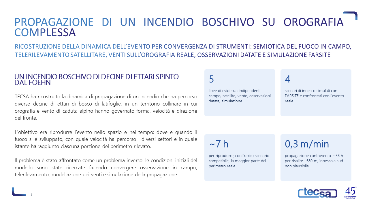
TECSA has reconstructed the spread dynamics of a fire that swept through several tens of hectares of deciduous woodland in a hilly area, where the terrain and a strong foehn wind determined the shape, speed and direction of the fire front. The aim was to reproduce the event in space and time: where and when the fire developed, at what speed it spread through the various sectors, and at what point it reached each section of the detected perimeter.
The approach
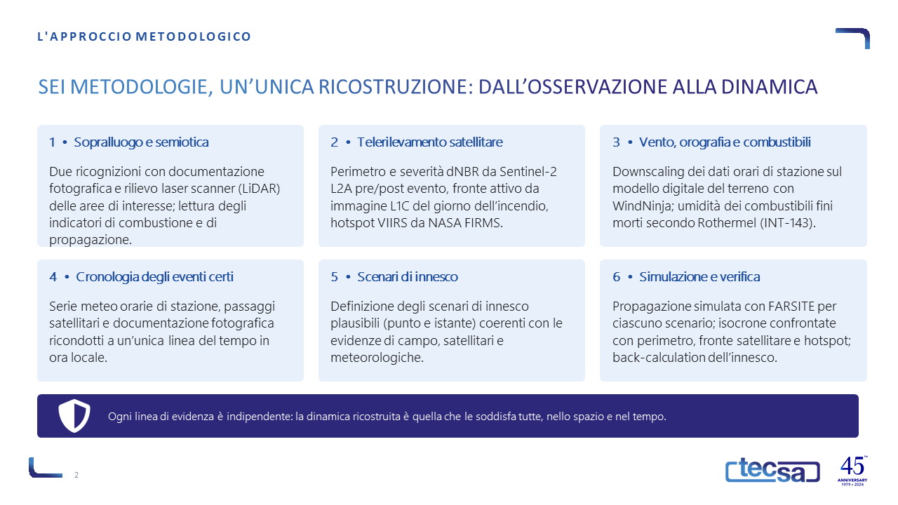
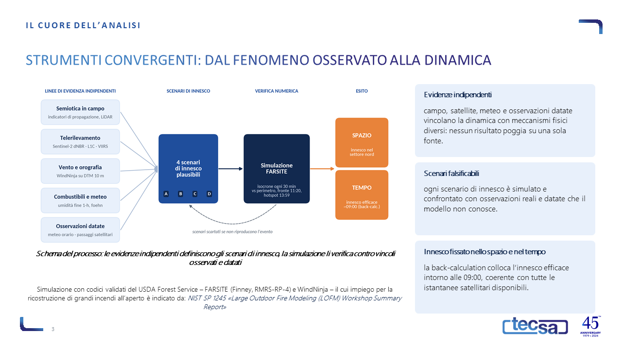
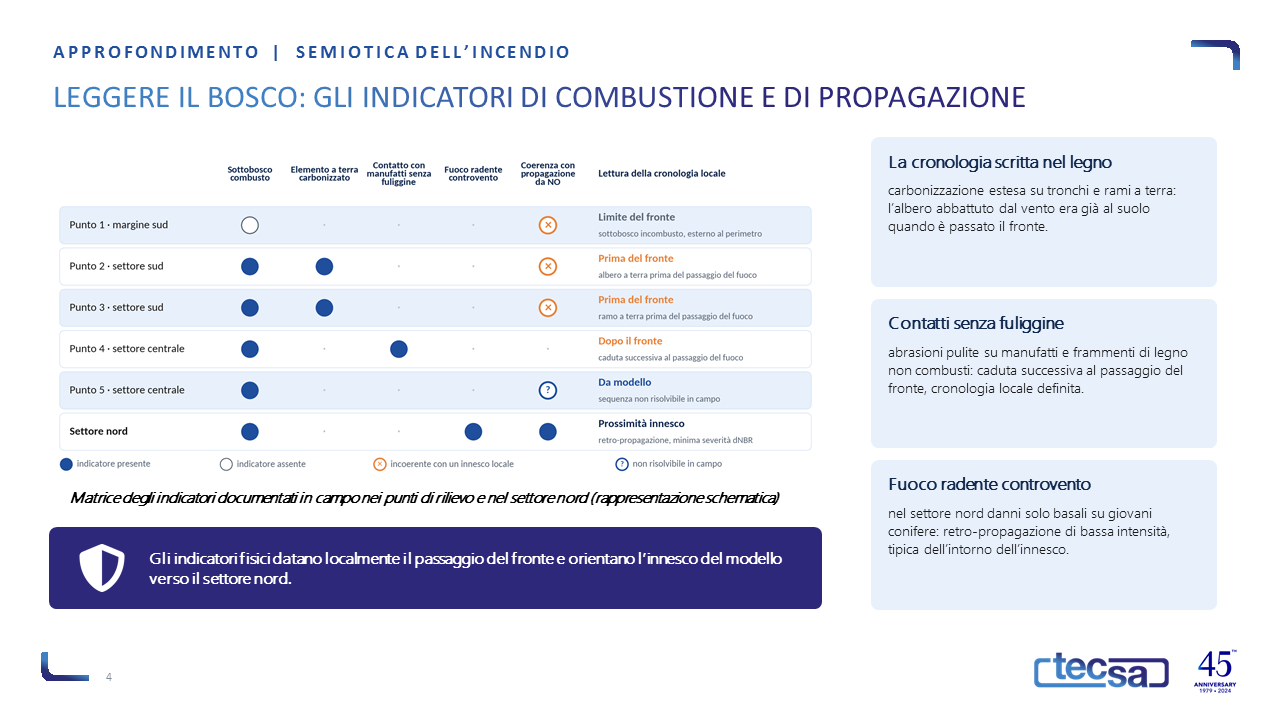
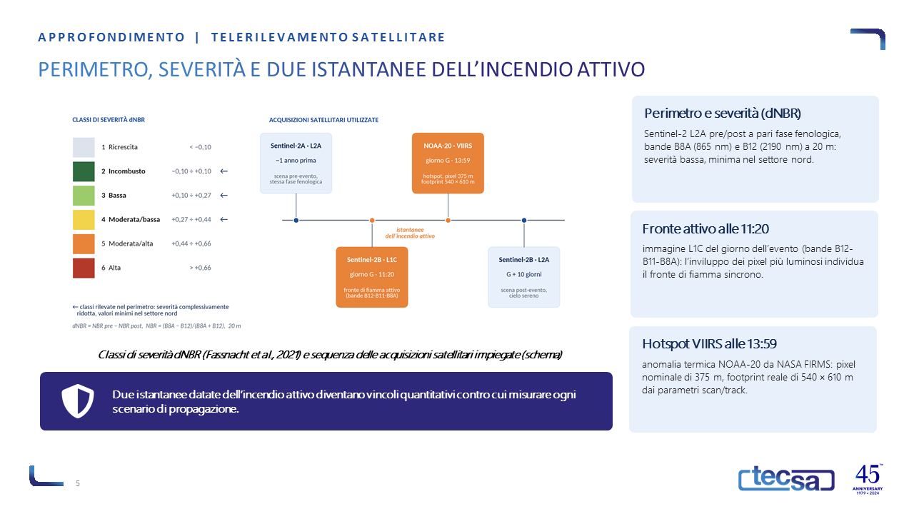
The problem was tackled as an inverse problem, by bringing together independent lines of evidence. In the field, two surveys using laser scanning enabled us to interpret the fire’s semiotics: charring that dates the felling of trees relative to the passage of the fire front, soot-free contact points, and basal damage typical of a ground fire burning against the wind. Satellite data provided the perimeter and nDBR severity (Sentinel-2), the active fire front at 11:20 (L1C image) and the VIIRS hotspot at 13:59 (NASA FIRMS).
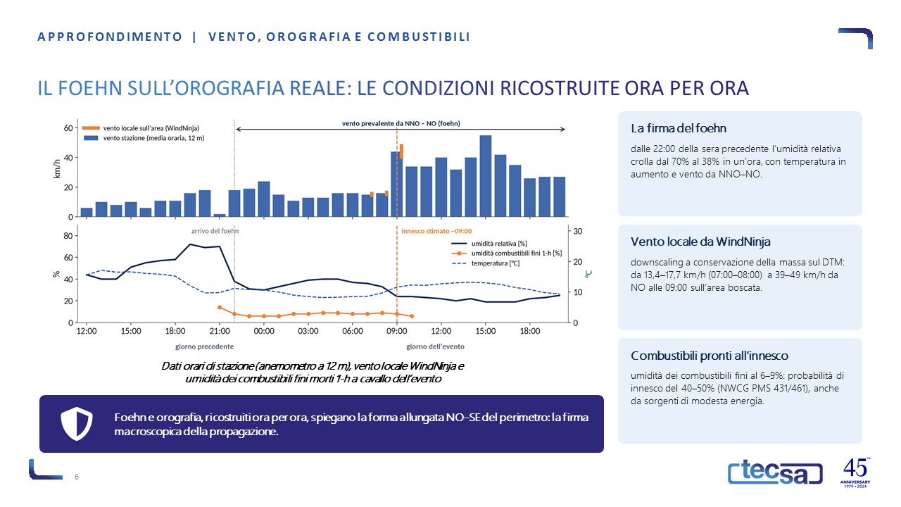
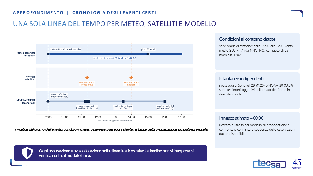
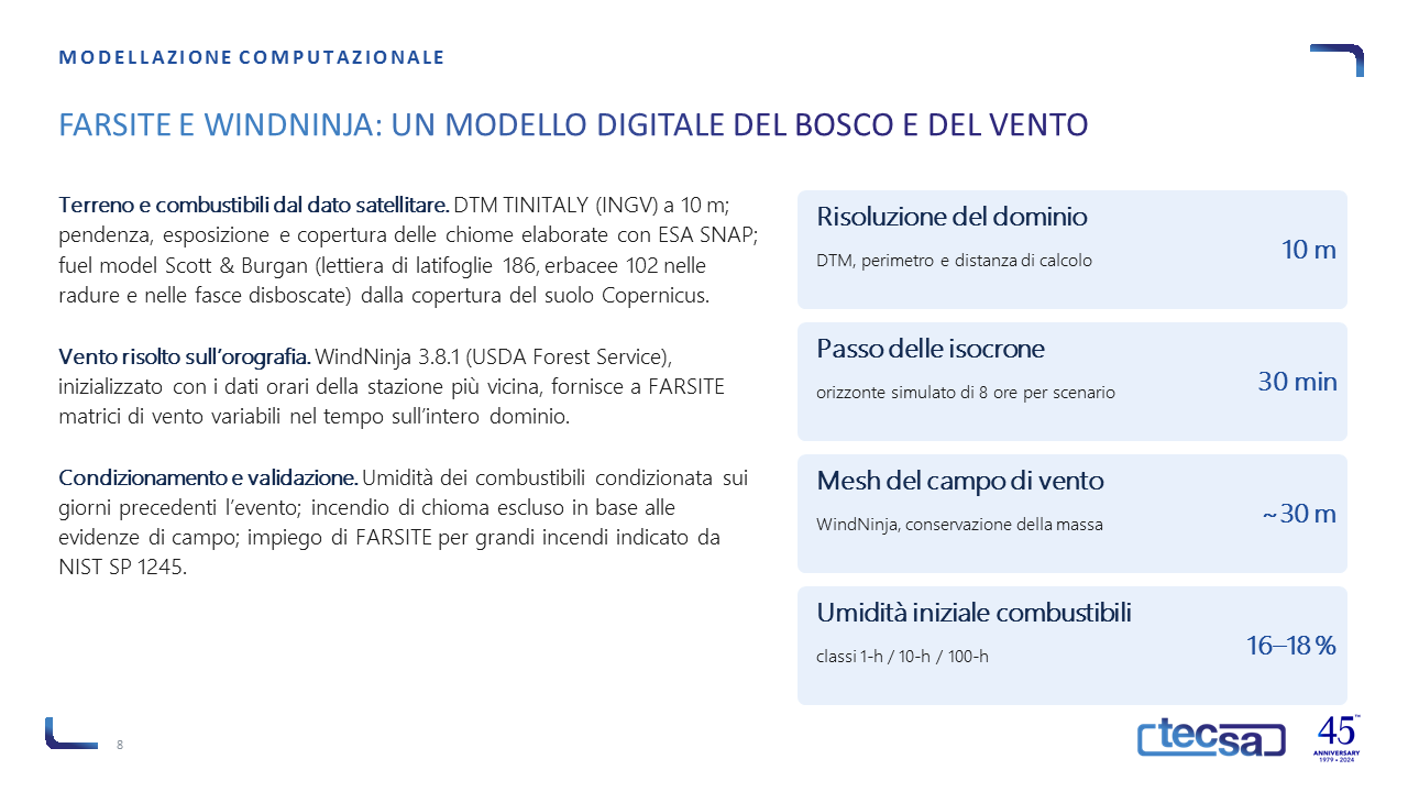
The wind field was reconstructed over the actual terrain using WindNinja based on hourly station data, documenting the arrival of the foehn and a moisture content of 6–9 per cent in the fine fuels. Weather series, satellite passes and survey data were integrated into a single timeline. Finally, four ignition scenarios were simulated using FARSITE and compared, isochron by isochron, with the observed constraints.
The results
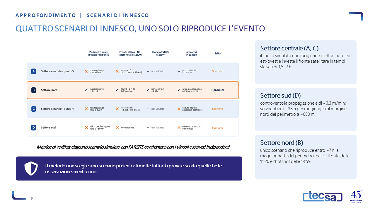
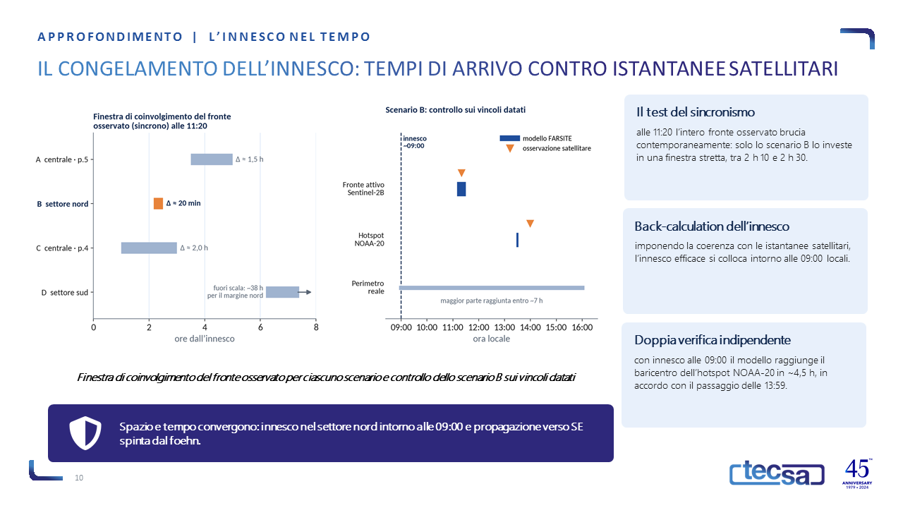
Only one scenario, with ignition in the northern sector, reproduces most of the actual perimeter within approximately 7 hours and simultaneously reaches the front observed at 11:20; the back-calculation places the effective ignition around 09:00, consistent with the 13:59 hotspot. The scenarios in the central sector produce extensions and timescales that are incompatible, whilst in the southern sector the upwind propagation of approximately 0.3 m/min would take around 38 hours to reach the northern margin. The result is a univocal dynamic, fixed in space and time.
Why TECSA
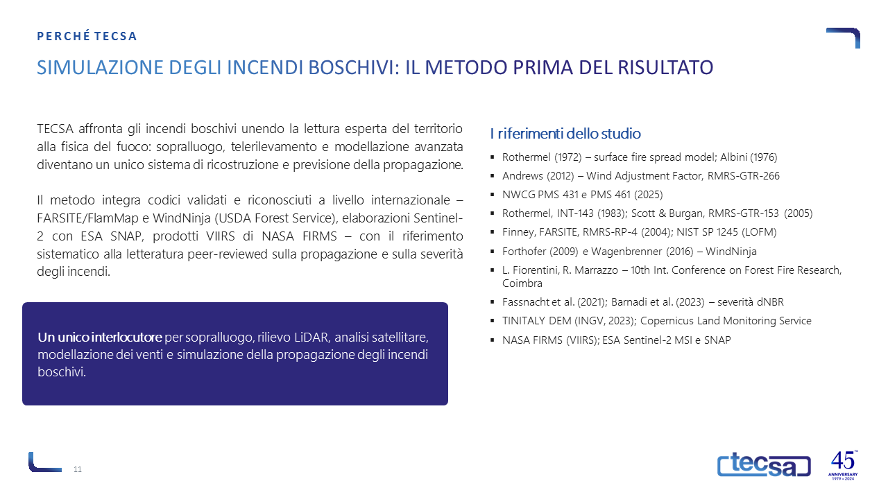
TECSA combines expert interpretation of the terrain with internationally validated and recognised models – FARSITE, WindNinja, Sentinel-2 and VIIRS products – with results traceable to measured data and technical-scientific literature. The same suite of tools supports fire planning and interface assessments, a field in which the contribution by L. Fiorentini and R. Marrazzo to the 10th International Conference on Forest Fire Research in Coimbra is situated.